Difference between revisions of "Talk:Sussex Towns and Villages S"
Darksecretz (talk | contribs) |
|||
| (4 intermediate revisions by one other user not shown) | |||
| Line 1: | Line 1: | ||
| + | ==Staplefield== | ||
| + | *[[Sussex_Towns_and_Parishes_S#STAPLEFIELD|Staplefield]] church is normally locked although the open porch has a plan with names of the burials in the churchyard. | ||
| + | |||
==South Stoke== | ==South Stoke== | ||
*[[Sussex_Towns_and_Parishes_S#South Stoke|St Leonards]] dates from the 11th century though the Victorian restoration has left it rather bare. It is built largely of flint, the porch is 13th century while the broach spire is 19th century. The original octagonal font with a canopy was destroyed during the restoration. There is no electricity though the village has been connected since 1950 so church has candlebras for lighting. The single bell bears the inscription "Bryanus Eldridge me fecit 1657" (during the Commonwealth). There is a tithe map of South Stoke at the back of the church. It was found unlocked on a Saturday. | *[[Sussex_Towns_and_Parishes_S#South Stoke|St Leonards]] dates from the 11th century though the Victorian restoration has left it rather bare. It is built largely of flint, the porch is 13th century while the broach spire is 19th century. The original octagonal font with a canopy was destroyed during the restoration. There is no electricity though the village has been connected since 1950 so church has candlebras for lighting. The single bell bears the inscription "Bryanus Eldridge me fecit 1657" (during the Commonwealth). There is a tithe map of South Stoke at the back of the church. It was found unlocked on a Saturday. | ||
| Line 10: | Line 13: | ||
</tr> | </tr> | ||
</table> | </table> | ||
| − | |||
| − | |||
| − | |||
| − | |||
| − | |||
| − | |||
<br> | <br> | ||
Latest revision as of 10:27, 28 November 2012
Staplefield
- Staplefield church is normally locked although the open porch has a plan with names of the burials in the churchyard.
South Stoke
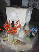
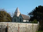
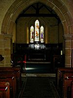
- St Leonards dates from the 11th century though the Victorian restoration has left it rather bare. It is built largely of flint, the porch is 13th century while the broach spire is 19th century. The original octagonal font with a canopy was destroyed during the restoration. There is no electricity though the village has been connected since 1950 so church has candlebras for lighting. The single bell bears the inscription "Bryanus Eldridge me fecit 1657" (during the Commonwealth). There is a tithe map of South Stoke at the back of the church. It was found unlocked on a Saturday.
Streat
- Streat church has no saint's dedication. I have always found it to be unlocked during the day. The porch contains a board with details of a local charity:
"A Bequest was made for the Benefit of the Poor of this PARISH by Wm CHEALE of CHARLWOOD inthe COUNTY of SURREY by his Will dated January 14th 1754 in which He desired that One Hundred Pounds, shall be paid to the Priest and Overseers of the POOR of the PARISH of STREAT. Which is to be put out to Interest or applied to the purchase of A piece of LAND, by which A sum may be Annually raised, for Persons who come under the following description, the Poor Widows and Fatherless Poor Children, the Poor, Lame, Blind Fatherless and Widows of the said Parish. The Hundred Pounds was laid out in the year 1767 by the MINISTER and OVERSEERS for the sole Benefit of a Purchase of A RENT charge of £3.0.0. for Copyhold lands, called Skinners in the Parish and Manor of Streat."


