Difference between revisions of "Maps: Tithe and Ordnance Survey"
Darksecretz (talk | contribs) |
|||
| (15 intermediate revisions by 3 users not shown) | |||
| Line 3: | Line 3: | ||
==Tithe maps== | ==Tithe maps== | ||
| − | [[image:boundary2a.jpg|right|thumb|250px| | + | [[image:boundary2a.jpg|right|thumb|250px|Tithe Map c1845. South Stoneham, Hampshire. ]] |
| − | |||
| − | A landowner had a tithe map drawn up in order to show not only his land, buildings and other assets, but also to show to whom he rented particular portions of land/buildings (tithe apportionment). There was no standard size or scale for | + | A tithe map is a detailed survey of a landscape, which denotes area boundaries and which was in common use prior to ordnance survey maps. |
| + | |||
| + | A landowner had a tithe map drawn up in order to show not only his land, buildings and other assets, but also to show to whom he rented particular portions of land/buildings (tithe apportionment). There was no standard size or scale for tithe maps | ||
Three copies were generally made: | Three copies were generally made: | ||
* The original for the Tithe Commissioners – now in The National Archives at Kew, <br> | * The original for the Tithe Commissioners – now in The National Archives at Kew, <br> | ||
| − | * One copy for the Diocese - the copy which which may be | + | * One copy for the Diocese - the copy which which may be available in County Record Offices<br> |
* One copy for the parish - as above<br> | * One copy for the parish - as above<br> | ||
You may find papers and letters relating to tithe payments made by parishioners in parish collections. | You may find papers and letters relating to tithe payments made by parishioners in parish collections. | ||
| − | The tithe was an annual payment of an agreed proportion (originally one-tenth) of the yearly produce of the land, so it was important that | + | The tithe was an annual payment of an agreed proportion (originally one-tenth) of the yearly produce of the land, so it was important that each area was marked accurately so as to establish the fair tithe. |
| − | + | *[http://www.hants.org.uk/westendlhs/tithehistory.html More about Tithes] Information about the History of Tithes, Maps, Apportionment Schedules & Awards. | |
| − | *[http://www.hants.org.uk/westendlhs/tithehistory.html More about Tithes] Information | ||
| − | about the History of Tithes, Maps, Apportionment Schedules & Awards. | ||
<br><br> | <br><br> | ||
| Line 26: | Line 25: | ||
[[image:chimap.jpg|left|thumb|250px|© 2007 Image Image produced from the Ordnance Survey Get-a-map service. Image reproduced with kind permission of Ordnance Survey and Ordnance Survey of Northern Ireland.]] | [[image:chimap.jpg|left|thumb|250px|© 2007 Image Image produced from the Ordnance Survey Get-a-map service. Image reproduced with kind permission of Ordnance Survey and Ordnance Survey of Northern Ireland.]] | ||
| − | Ordnance survey is a collection of maps, of a standard scale and size, and more detailed than a | + | Ordnance survey is a collection of maps, of a standard scale and size, and more detailed than a tithe map. Begun in 1840, this is the first comprehensive historic mapping of England, Scotland and Wales. In 1841, the Ordnance Survey Act gave map makers a legal right to 'enter into and upon any land' for survey purposes. January 1st 1841 saw the publication of the first of these standardised maps, it was of Kent, although use of the name 'ordnance survey' wasn't used until c1810. |
| − | Although OS maps do not give any information about the occupants of an area, | + | Although OS maps do not give any information about the occupants of an area, they do include geographical features we would expect to find on modern maps. The maps are detailed enough to show the existence of a building as well as giving a clear idea of the topography of an area. Churches, pubs, farms, mines, factory works and important houses are often named, although roads are usually not. |
[http://www.alangodfreymaps.co.uk/ The Godfrey Edition] This company produces reprints of Old Ordnance Survey Maps of towns throughout Britain and Ireland. Most of the maps are highly detailed, and reprinted at about 14 inches to the mile. They cover towns in great detail, showing individual houses, railway tracks, factories, churches, mills, canals, tramways and even minutiae such as dockside cranes, fountains, signal posts, pathways, sheds, wells, etc.. Each map includes historical notes on the area concerned. Many also include extracts from contemporary directories. | [http://www.alangodfreymaps.co.uk/ The Godfrey Edition] This company produces reprints of Old Ordnance Survey Maps of towns throughout Britain and Ireland. Most of the maps are highly detailed, and reprinted at about 14 inches to the mile. They cover towns in great detail, showing individual houses, railway tracks, factories, churches, mills, canals, tramways and even minutiae such as dockside cranes, fountains, signal posts, pathways, sheds, wells, etc.. Each map includes historical notes on the area concerned. Many also include extracts from contemporary directories. | ||
<br><br> | <br><br> | ||
| − | *[http://www.old-maps.co.uk Old Maps] Note that the counties listed are as they were back in the mid | + | *[http://www.old-maps.co.uk Old Maps] Note that the counties listed are as they were back in the mid 19th century. The resulting place names listing is based on the current Ordnance Survey 1:50,000 gazetteer. This is useful for surveying areas of mapping where settlements have been developed since the time of the mapping. |
<br><br> | <br><br> | ||
'''Other useful types of maps and mapping''' | '''Other useful types of maps and mapping''' | ||
| Line 43: | Line 42: | ||
| − | + | See also [[Maps and Photography]] | |
Back to [[Records Office Guide]] | Back to [[Records Office Guide]] | ||
Latest revision as of 08:30, 25 September 2022
Contents
Tithe maps
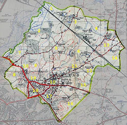
A tithe map is a detailed survey of a landscape, which denotes area boundaries and which was in common use prior to ordnance survey maps.
A landowner had a tithe map drawn up in order to show not only his land, buildings and other assets, but also to show to whom he rented particular portions of land/buildings (tithe apportionment). There was no standard size or scale for tithe maps
Three copies were generally made:
- The original for the Tithe Commissioners – now in The National Archives at Kew,
- One copy for the Diocese - the copy which which may be available in County Record Offices
- One copy for the parish - as above
You may find papers and letters relating to tithe payments made by parishioners in parish collections.
The tithe was an annual payment of an agreed proportion (originally one-tenth) of the yearly produce of the land, so it was important that each area was marked accurately so as to establish the fair tithe.
- More about Tithes Information about the History of Tithes, Maps, Apportionment Schedules & Awards.
Ordnance survey maps
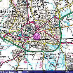
Ordnance survey is a collection of maps, of a standard scale and size, and more detailed than a tithe map. Begun in 1840, this is the first comprehensive historic mapping of England, Scotland and Wales. In 1841, the Ordnance Survey Act gave map makers a legal right to 'enter into and upon any land' for survey purposes. January 1st 1841 saw the publication of the first of these standardised maps, it was of Kent, although use of the name 'ordnance survey' wasn't used until c1810.
Although OS maps do not give any information about the occupants of an area, they do include geographical features we would expect to find on modern maps. The maps are detailed enough to show the existence of a building as well as giving a clear idea of the topography of an area. Churches, pubs, farms, mines, factory works and important houses are often named, although roads are usually not.
The Godfrey Edition This company produces reprints of Old Ordnance Survey Maps of towns throughout Britain and Ireland. Most of the maps are highly detailed, and reprinted at about 14 inches to the mile. They cover towns in great detail, showing individual houses, railway tracks, factories, churches, mills, canals, tramways and even minutiae such as dockside cranes, fountains, signal posts, pathways, sheds, wells, etc.. Each map includes historical notes on the area concerned. Many also include extracts from contemporary directories.
- Old Maps Note that the counties listed are as they were back in the mid 19th century. The resulting place names listing is based on the current Ordnance Survey 1:50,000 gazetteer. This is useful for surveying areas of mapping where settlements have been developed since the time of the mapping.
Other useful types of maps and mapping
- Valuation Maps: Revaluation of land values carried out by the Inland Revenue after 1910
- Surveys of manors and estates: the Lord of a Manor or the owner of a particular estate may have commissioned a survey to be carried out to record the extent of his lands, or to show alterations to the estate.
- Highway Diversions: made by the order of Quarter Sessions, these maps show the diversion or stopping up of footpaths and highways in the nineteenth century
See also Maps and Photography
Back to Records Office Guide

